
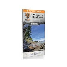
Featuring vast stretches of undisturbed rainforest, towering mountains surrounded by pristine lakes, thousands of kilometres of coastline teeming with marine life and a variety of quaint, charming communities, Northern Vancouver Island offers endless opportunities for adventure. With just one major roadway reaching the northern extents of the Island, this is a place where nature rules and stress melts away.
To make navigating this sparsely populated region easier, the BRMB team have worked tirelessly to create the most comprehensive, detailed and easy-to-use map for Northern Vancouver Island you will find anywhere. This dual sided 34” x 46.25” map is printed on durable, waterproof paper to withstand any storm or gale. With industry-leading cartographic detail, state-of-the-art relief shading, colour-coded Provincial Parks and more, there isn’t an easier-to-read map on the market. This map contains countless points of interest, hiking trails, campsites, beaches, paddling routes and more, so no matter what you are looking for, you can find it on our Northern Vancouver Island Waterproof Map. This map also features detailed descriptions of recreation sites and parks with information on camping, fees, activities, access and more. Covering the areas around Port Hardy, Port McNeill, Gold River, Campbell River, Courtenay/Comox and more, this is your ultimate guide to exploring one of the most breathtaking areas in the world.
-
2 Maps in 1 oversized format (86 × 117 cm / 34 × 46.25 in) - Created in partnership with Recreation Sites and Trails BC for unmatched local expertise
- Unparalleled road coverage including highways, city roads, logging and industry roads
- Multi-use trails for hikers, mountain bikers, horseback riders, cross-country skiers and snowshoers
- Paddling routes for canoers and kayakers
- Fishing information with updated fish species
- Industry leading cartographic detail and state of the art topographic relief and shading
- Waterproof and tear-resistant construction built to withstand rain, mud, snow, and rough handling
- Industry leading cartographic detail and state of the art topographic relief and shading
- GPS-Compatible: Seamlessly integrates with GPS devices and mobile apps for reliable navigation
