
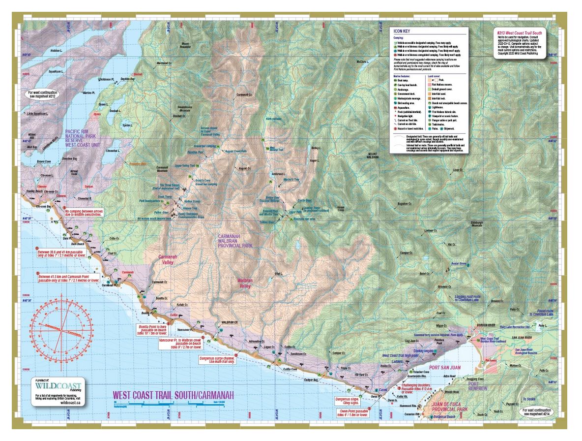
About the West Coast Trail: The West Coast Trail is a 78-km wilderness corridor along an exposed stretch of coast known for its rugged inaccessibility, storms and wild rainforests. Improvements to the trail over the years by Parks Canada, such as ladders and boardwalks, have tamed it somewhat, but it continues to be one of the more difficult and challenging routes along the Pacific coast. With limited road access through the region it remains largely a wilderness area, with just Bamfield, Nitinat and Port Renfrew providing access points. The following information is provided to augment the Parks Canada information provided at the trailhead orientation sessions, as well as to provide the basics for trip planning (and inspire you, of course!). Be sure to see mapsheet #212 for details needed to best complete this hike.
About this mapsheet: This mapsheet covers the West Coast Trail as a hiking resource, and expands the coastal route into a regional overview including Carmanah and Walbran Valleys, for those who want to turn a trail hike into a larger exploration of the region. But it is also a marine mapsheet to facilitate a coastal transit as part of the Wild Coast marine mapsheet series that when complete will provide an unbroken overview of the entire British Columbia coastline. As such it is part of the hybrid Wild Coast marine and trail mapsheet series. It should be coupled with Mapsheet #212 West Coast Trail North to complete the trail in its entirety.
