
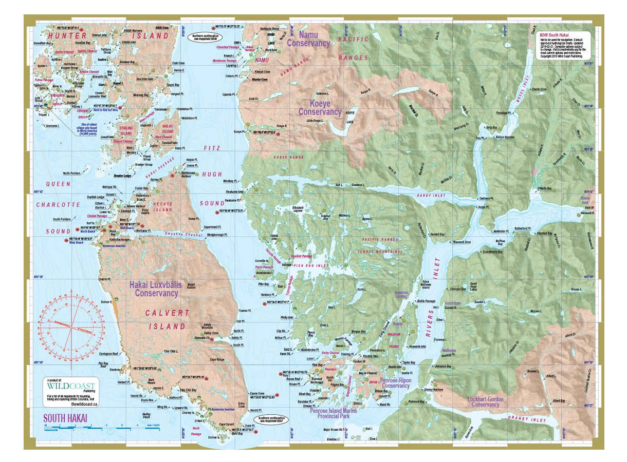
About this region: It is just 82 kilometres from Port Hardy to the south end of Calvert Island, but despite that relatively short distance, the area around South Hakai is among the most isolated and least visited regions along the British Columbia coastline. This is a symptom of the geography – no roads to speak of, no communities beyond what could be described as small encampments, and challenging, volatile water routes to get here.
A common path for visitors to Bella Bella is to head south down Raymond Channel to go as far as your interests, ability and luck with weather take you. An obvious destination is Calvert Island, covered in detail on this mapsheet, but there are enough passages, inlets and lagoons here to keep you busy exploring for a lifetime. A problem can be that good camping locations are few and far between and/or difficult to reach, but when you find one, it is usually sublime – a wilderness getaway about as remote and wild as wild can still be.
About this mapsheet: This mapsheet covers the waterways and archipelagos of the south end of Hakai Lúxvbálís Conservancy and all of Rivers Inlet, including Namu, Fish Egg Inlet, Hakai Passage and Penrose Island Provincial Park. It will be invaluable for an Inside Passage Transit for the area from Rivers Inlet to Namu. The north continuation is mapsheet #249, which includes Bella Bella and the surround archipelagos.
